




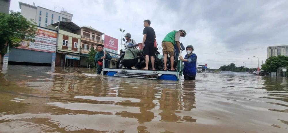
Typhoon Narra is moving away from northern Vietnam, bringing some relief to Hanoi and other areas after days of heavy rain. The storm was over the sea south of Bach Long Vi on August 25. Its winds had also weakened.
The storm was moving east and then northeast. It was expected to stay over the Gulf of Tonkin before weakening further. Rain across much of northern Vietnam was forecast to fall sharply from the afternoon of August 25.
The weaker storm does not mean the danger has ended. Rivers in parts of northern Vietnam remain high. Some rivers are still above the highest flood warning level. This keeps the risk of flooding in low areas.
Hanoi has also faced high river levels. Several rivers around the capital were above warning levels early on August 25. The Tich River, Bui River and Cau River were among the rivers that remained a concern.
Several water reservoirs around Hanoi have also reached their spillway levels. Some reservoirs have released water through spillway gates. Local officials are watching river and reservoir levels closely as the storm moves farther away.
The storm brought heavy rain to northern Vietnam over the past few days. The rain caused flooding, landslides and damage in several provinces. More than 1,000 hectares of crops were reported flooded or damaged in Lang Son, Bac Ninh and Quang Ninh.
Flooding also caused problems on roads. Hundreds of sites were affected by floods or landslides in some northern areas. Some homes in areas at risk were moved to safer places. Officials also worked to keep roads open and protect people in areas facing danger.
The storm was also linked to serious flooding and landslides before moving away from the coast. Heavy rain raised river levels and caused damage to homes and farmland in northern provinces. Emergency teams were sent to areas at risk.
Hanoi was not in the area of the storm’s strongest winds. However, the capital was affected by the storm’s wider circulation and heavy rain. Weather officials warned that storms and strong rain could still occur in some places.
By early August 25, the main storm center had moved farther offshore. Its strongest winds were about 62 to 74 kilometers per hour, with stronger gusts. Forecasters expected the system to keep moving away from Vietnam and weaken.
The change in the storm’s path is good news for northern Vietnam. Less rain should help rivers fall and reduce pressure on flooded areas. Still, the danger will not end at once. Saturated ground can remain unstable after several days of rain.
People in flood prone areas have been urged to stay alert. Officials are also checking roads, bridges and other key sites. Landslides remain possible in areas where the soil is wet and weak.
The storm is expected to continue weakening as it moves away. Northern Vietnam should see better weather in many areas. However, local rain can still cause problems where rivers remain high.
For Hanoi, the main concern now is the water left behind by the storm. City officials must watch rivers, reservoirs and low areas as water levels change. A fall in rainfall will help, but safe conditions will depend on how fast the flood water recedes.
Typhoon Narra shows how quickly weather risks can change in northern Vietnam. A storm may weaken at sea while its effects remain on land. For now, the focus in Hanoi and nearby areas is on falling river levels, safer roads and continued monitoring.
