




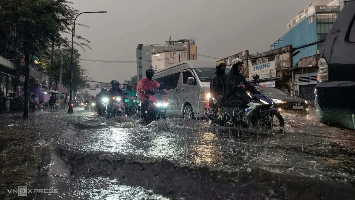
Ho Chi Minh City and the broader southern Vietnam region are bracing for five consecutive days of heavy rainfall beginning today, driven by a low pressure trough linked to cold air moving down from the north. The forecast disruption comes at a particularly inconvenient time for the sprawling southern metropolis, with heavy traffic already choking streets around Tan Son Nhat airport even before the worst of the rainfall arrives.
Meteorological officials have attributed this rain event to the interaction between northern cold air and existing low pressure conditions across the region, a weather pattern that has historically produced significant flooding challenges for Ho Chi Minh City given the metropolitan area’s ongoing struggles with inadequate drainage infrastructure relative to its rapid urban growth. The five day duration means residents and businesses across the city face an extended stretch of disrupted daily routines rather than a single passing storm.
Ho Chi Minh City has long grappled with recurring flood issues during heavy rain events, a challenge stemming from a combination of factors including rapid urbanization that has paved over natural water absorption areas, aging drainage systems struggling to handle modern rainfall volumes, and the city’s low lying geography that makes it particularly vulnerable to water accumulation during intense downpours. City officials have invested in various flood mitigation infrastructure projects over recent years, though the scale of the challenge means significant disruption during heavy rain periods remains a persistent reality for residents.
Transportation disruption represents one of the most immediate practical concerns tied to this forecast rain event, with the area surrounding Tan Son Nhat International Airport already experiencing heavy congestion. Airport adjacent traffic tends to worsen considerably during heavy rain periods, as reduced visibility and standing water on roadways slow vehicle movement precisely in areas that need to maintain efficient flow for passengers making time sensitive flight connections.
Local authorities typically respond to forecast heavy rain events like this one by activating pumping stations, deploying additional traffic personnel to manage congestion at flood prone intersections, and issuing public advisories encouraging residents to adjust travel plans where possible during the most intense rainfall periods. Businesses across the city, particularly those in ground floor commercial spaces in historically flood prone districts, often take precautionary measures including sandbag placement and protective barriers ahead of extended rain events.
This forecast rain spell arrives during what has already proven a consequential year for extreme weather across Vietnam, with various regions experiencing significant flooding, landslides, and storm damage at different points throughout 2026. Southern Vietnam’s monsoon season timing means late September rain events like this one remain a regular seasonal occurrence, even as climate patterns have shown increasing volatility in recent years according to meteorological tracking.
For residents planning activities over the coming days, weather officials have recommended monitoring updated forecasts closely, since the exact intensity and timing of the heaviest rainfall periods can shift as the broader weather system continues developing. Motorcycle commuters, who make up the vast majority of daily traffic across Ho Chi Minh City, face particular exposure to the practical challenges this kind of extended heavy rain period creates for daily movement around the city.
As today marks the beginning of this five day weather event, attention will focus on how effectively the city’s flood management systems perform under sustained rainfall pressure, offering an important test case for infrastructure investments made in recent years even as the underlying drainage capacity challenges facing Ho Chi Minh City remain a longer term structural issue extending well beyond any single weather event.
